
Purchase Imagery/DEMs
Thank you for your interest in Apollo Mapping’s imagery and DEMs!
We provide a streamlined process for purchasing satellite imagery and digital elevation models (DEMs). Whether you need high-resolution imagery for modeling environmental impacts, medium-resolution imagery for monitoring or DEMs for mineral exploration, we respond promptly! We offer ready-to-go images without coding or APIs, ensuring efficient delivery within your budget.
Let’s get started by sharing your project needs on the form below:
"*" indicates required fields
Purchasing High and Medium-Resolution Satellite Imagery From Apollo Mapping
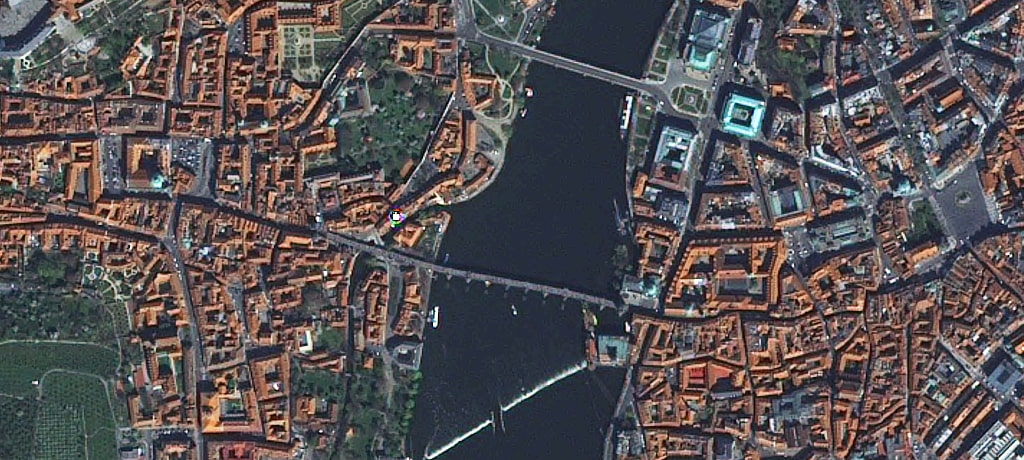
Thank you for your interest in Apollo Mapping’s imagery and digital elevation models (DEMs)! As part of our service to deliver streamlined satellite imagery and DEMs, we believe in responding quickly whether you require medium-resolution imagery for monitoring remote sites and detecting large landscape changes to the highest-resolution imagery for modeling the environmental impacts of a new housing community. We value you, clients who need imagery to complete tasks but don’t want to code or invoke an API for your project. We understand that you just need ready-to-go images to proceed with your job as quickly as possible while honoring your budget.
There are two easy ways to access satellite imagery and DEMs from Apollo Mapping:
-
You know what you’re looking for, but what does that cost?
If you want to see all the available data for your area and select your preferred images yourself, you can use our imagery search engine, Image Hunter.
Browse to your location > Select the area polygon > Select the satellite and date > And finally click “Submit for Quote.” -
You need help deciding which satellite imagery or DEMs products are right for your project and budget?
Tell us about your project on the short form above so we can quickly get you focused on the right imagery solution. An Apollo Mapping representative will explore our collection of aerial and satellite imagery products and DEMs, then suggest the options that are best for your project and budget. Also, feel free to upload information about the area you are searching for in a wide variety of formats, including JPEG, PDF and KMZ/KML.
Just have questions about satellite imagery and DEMs?
Complete the form above with any questions you might have about high-resolution imagery, DEMs, or any of the other products/services we offer here at Apollo Mapping. We’ll happily answer any questions to make the process easy for you.
What do you need from your imagery?
-
-

Highest resolution, most spectral bands, more collections, and the best positional accuracy? If your project demands the highest resolution imagery available and/or requires spectral analysis, then WorldView-3 should be your first choice. And with an archive that grows by nearly 680,000 square kilometers (sq km) per day, we are sure to have the imagery you need! LEARN MORE
-
-
-

Improved spectral analysis, extreme agility, and high accuracy? WorldView-2 features the first 8-band multispectral imaging system, adding a coastal, yellow, red edge and an additional near-infrared red (NIR) band to the traditional four (i.e. blue, green, red and NIR). Positioned 770 kilometers (km) above the planet, WorldView-2 collects up to 785,000 sq km of 8-band imagery every day. No wonder it’s our best seller! LEARN MORE
-
-
-

Crisp resolution, diverse spectral bands, frequent revisits, and a robust archive of coverage? The WorldView Legion constellation allows Apollo Mapping to offer increased imaging capacity and faster delivery times to its customers across various sectors, including defense, mining, oil and gas, engineering, education and research, and humanitarian relief. LEARN MORE
-
-
-

Daily global coverage, multiple imaging modes, and a quick response for emergencies? The Pléiades 1 twins are exceptionally agile with the ability to collect one million square km of high-resolution imagery per day, per satellite. Featuring daily revisit time to any location on the planet, the Pléiades constellation separates itself from the competition for site monitoring and projects requiring rapid imagery acquisitions. LEARN MORE
-
-
-

Near real-time imagery, massive global archive, daily monitoring, and red edge spectral data? Planet continues to improve their Doves with multiple launches each year – a major differentiator to macro-satellites like WorldView-3 which only improve every 5 to 10 years with a new launch. LEARN MORE
-
-
-

Millions of square kilometers per day, 6-band multispectral, twice a day visits, and fully commercial? Along with the 30-cm panchromatic band, Pléiades Neo boasts six 1.2-meter (m) multispectral bands, including deep blue, blue, green, red, red edge, and near-infrared. Pléiades Neo is entirely open to commercial clients, with no government ownership of tasking time, thereby increasing its collection capacity. LEARN MORE
-
What do you need from your DEMs?
-
-
- Instant DEMs, Multiple formats, and cloudy locations? WorldDEM and WorldDEM Neo are created from radar data which can pass through clouds, so they are an ideal elevation solution for the cloudiest of places. WorldDEM is the ideal solution for all mapping projects requiring accurate elevation models including orthorectification, floodplain determination, mineral exploration and hydrocarbon development. LEARN MORE
- High resolution, superior accuracy, and wide availability? As all Precision3D products are derived from The Globe in 3D, the layers are perfectly georegistered and maintain the highest accuracy throughout their entire suite of offerings, be it 50-centimeter or 5-meter Digital Terrain Models (DTMs) or Digital Surface Models (DSMs). These DEMs boast an impressive absolute vertical and horizontal accuracy of 3-meter LE90/CE90 – achieved without the need for ground control points. LEARN MORE
-
What resolution imagery do you need?
The uses of medium and high-resolution aerial and satellite imagery are as vast as the human imagination. Here are two lists of several situations when it makes the most sense to use high and medium-resolution imagery.
| High-Resolution Scenarios: | Medium-Resolution Scenarios: |
|---|---|
| Plan the location of a solar and/or wind farm | A cost-effective means to obtain base layer imagery for large areas |
| Assess the health of urban forest canopies | In regions with historically high-cloud cover and thus lack of coverage with high-resolution imagery |
| Construct accurate topographic models | Monitor remote sites and detect large landscape changes |
| Digitize surface cracks on rapidly melting glaciers | For projects that require the most up-to-date imagery over large areas |
| Plan field survey locations and methodology | Predict regional agricultural yields before harvest |
| Model the environmental impacts of a new housing community, particularly on the local plant species | Marco-scale spectral analysis that requires multiple temporal datasets |
| Trace footpaths and roadways in rural and urban environments | Replace Landsat 7 imagery that has missing scan lines |
| Assess the amount of new building in an urban environment via change detection | Supplement free lower-resolution satellite imagery such as ASTER and MODIS |
How long will it take to receive my imagery?
Great question! The answer is that it depends on a few variables, but one of the main factors is whether we can find your imagery in an archive or if we will have to place a tasking order.
-
-
- Tasking Order – A tasking order is an on-demand service whereby clients define a custom polygon on the planet to be imaged by the next available high or medium-resolution satellite. The time to collect this area of interest is controlled by local weather conditions and competition from surrounding tasking orders.
- Archive Order – An archive order relies on a historic database of high and medium-resolution aerial and satellite imagery with a specific time/date stamp and known cloud cover. Clients can browse available data with the assistance of Apollo Mapping to determine the best imagery for their intended applications. Once paid for, most archive orders deliver in 1 to 2 business days.
-
What other services are available at Apollo Mapping?
We can help you with Post Processing or locating historic imagery. We also have a replete collection of free resources: How To’s, technical documents, and our Image Hunter Guide.
We look forward to working with you in the near future!
An Apollo representative will contact you by email or phone within 4 business hours of your contact form submission. We value your time and are ready to assist.
